FORECAST
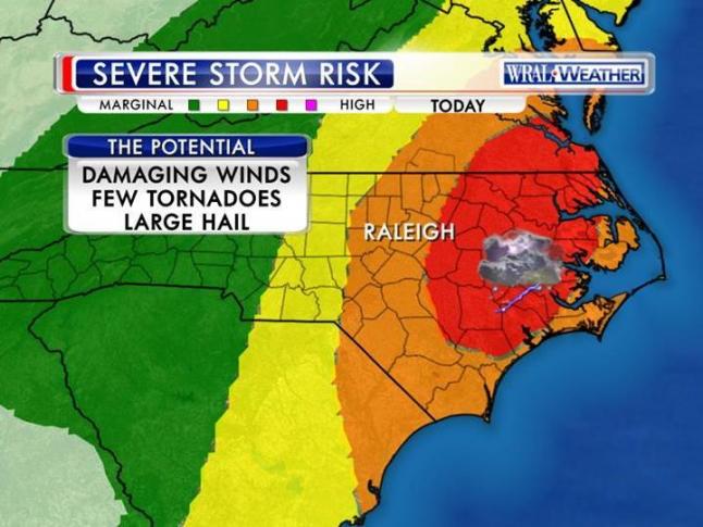
Two bands of severe storms bearing down on Central North Carolina Wednesday 2/24 are threatening to produce tornadoes and large hail. Severe weather is looking more likely late morning through early afternoon today. The main threat would be from damaging straight line winds, though isolated tornadoes are also possible. Heavy rain and minor flooding are also possible. The strong storms moving up from the South will bring sustained winds of 20-25 mph, placing our region under a wind advisory–separate from the tornado threat–from 9am to midnight. The threat of tornadoes, though, is likely to cause a tornado watch later this morning.
STAY CONNECTED
Piedmont Electric is on alert and will be providing ongoing communications and weather monitoring. If a power outage occurs, Piedmont Electric customers should report the outage to 800.449.2667. You can also check our online Outage Map Viewer which provides detailed outage information, including location. If you would like to understand how power is restored after a major outage, check out our “Steps to Restoring” graphic here.
BE SAFE: STAY AWAY FROM DOWNED POWER LINES
PEMC reminds members to stay away from downed power lines or fallen trees/limbs that may be in close proximity to power lines. Do not to attempt to move downed lines under any circumstances, and exercise extreme caution around any damaged electrical infrastructure. Please report any damage to the Cooperative and/or local law enforcement in the event of an emergency.